
Maps
![]()


A WAFERx Storymap
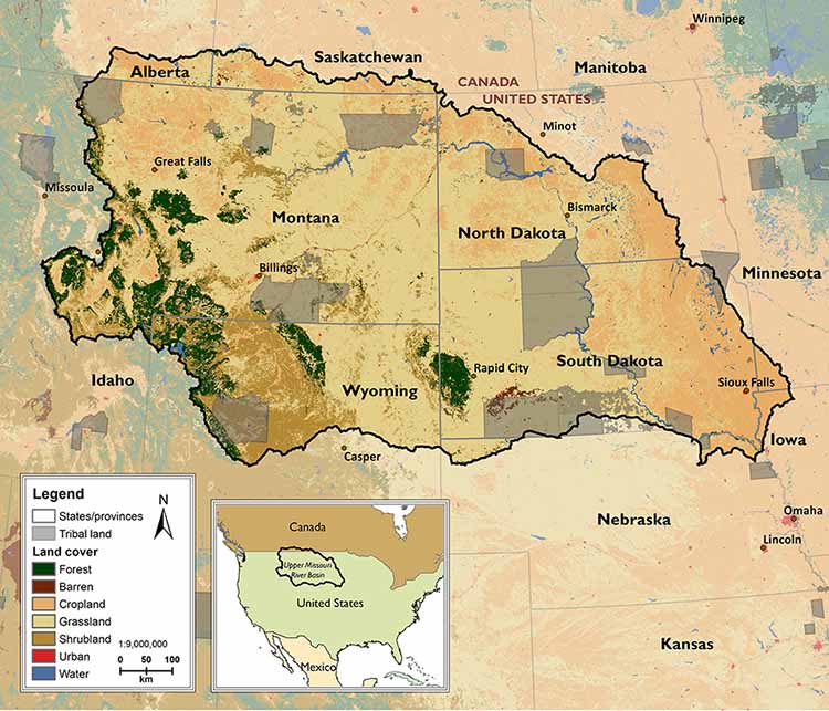
Source: National Land Cover Database
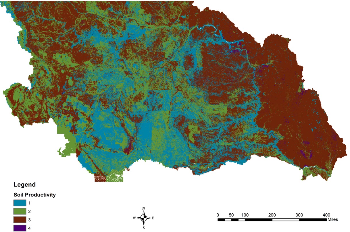
(1 (teal) is the least productive and 4 (purple) is the most productive soil)
Source: USDA Forest Service Soil Productivity Index
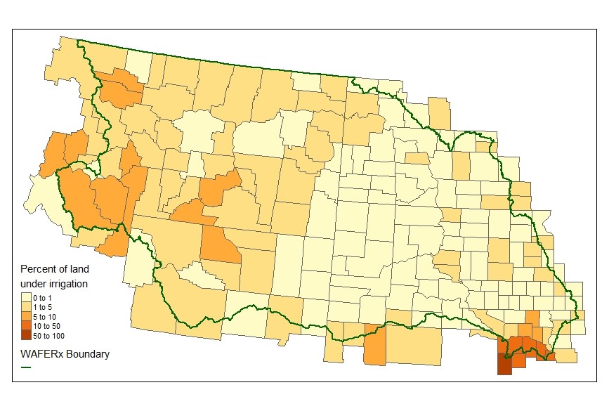
Source: USGS
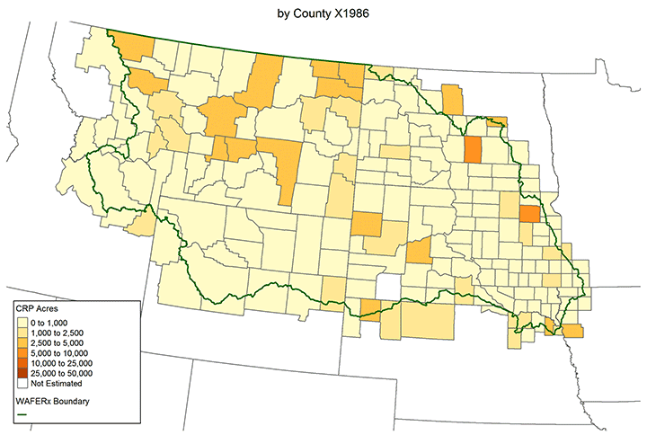
Source: USDA Farm Service Agency, Conservation Reserve Program Statistics
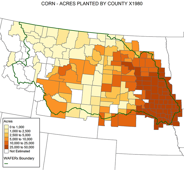
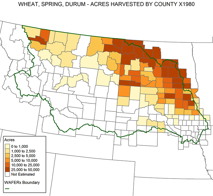
Source: USDA NASS Survey data
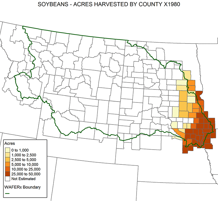
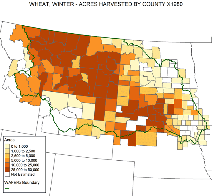
Source: USDA NASS Survey data
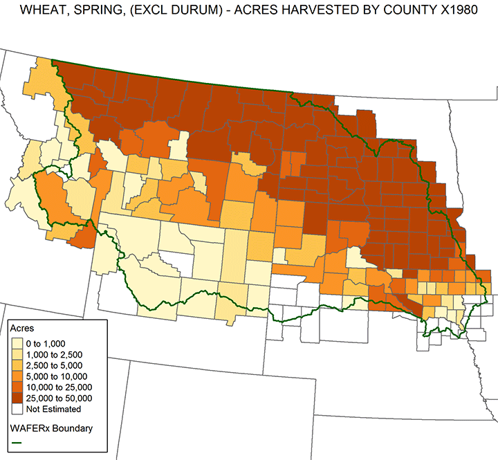
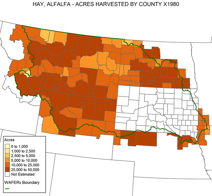
Source: USDA NASS Survey data
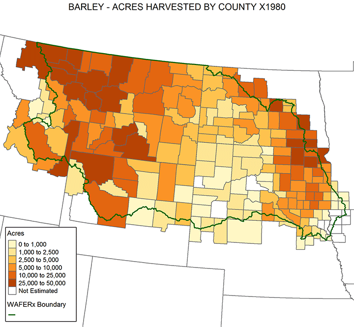
Source: USDA NASS Survey data
Source: USDA NASS Survey data
Source: USDA NASS Survey data
Source: USDA NASS Survey data
Contact Us
WAFERx
Montana State University
P.O. Box 1234
Bozeman, MT 59717-1234
Montana State University
P.O. Box 1234
Bozeman, MT 59717-1234